Our work includes large, complex and strategic-level studies with national governments, development agencies and the World Bank as well as competitively priced, quality services to industry.
Our service is highly specialised, focused on the collection, compilation, value adding, interpretation and serving of geodata to incentivise and support mineral exploration.
We…
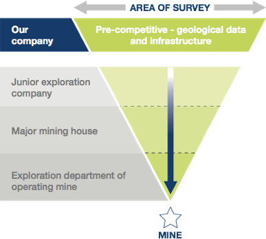
Assist national governments to implement large geodata mapping programmes to update and modernise their data holdings. This includes compiling terms of reference, implementing and supervising programmes and quality control monitoring.
Provide objective technical, financial and organisation assessments of governmental mineral support programmes through detailed scoping studies. We review and formulate policy and build capacity at technical and managerial levels.
Use and manage a large network of experienced geoscientists and project managers.
Compile mineral resource inventories, metallogenic and prospectivity maps.
Compile mineral promotion materials such as brochures and CDs at a regional and national scale to publicise prospective terrains for investors.
Develop geodata management systems to improve accessibility of geodata to the mineral exploration sector.
Build capacity in the geosciences at a technical and managerial level.
Provide expert advice and draw on experience of many national geological surveys to assist in restructuring, strategic review and implementing strategic plans.
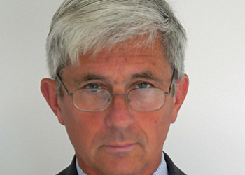
Professor Garth Earls
Executive Chairman
Garth Earls is a geologist with over 40 years’ experience in technical, managerial and leadership roles in a range of private and public sector organizations. He was part of the team that discovered the 6 Moz Curraghinalt gold deposit and has worked internationally on a wide range of deposit types and projects. As Director of the Geological Survey of Northern Ireland he was responsible for the delivery of the multidisciplinary regional Tellus project.
Garth is a Director of several exploration companies including Conroy Gold and Natural Resources, Minco Exploration and Central Asia Resources. He is a former Director of CSA (Dublin), Dalradian Gold and Premier Gold Resources. He teaches part of the Economic Geology course at University College Cork.
Geologist with over 30 years of experience. Previously Executive Manager Regional Geoscience and Mapping at the Council for Geoscience, South Africa, where he was responsible for national and commercial international multi-million dollar programmes and capacity-building initiatives. He has experience in reform and restructuring of National Geological Survey Organisations e.g. Botswana and Algeria.
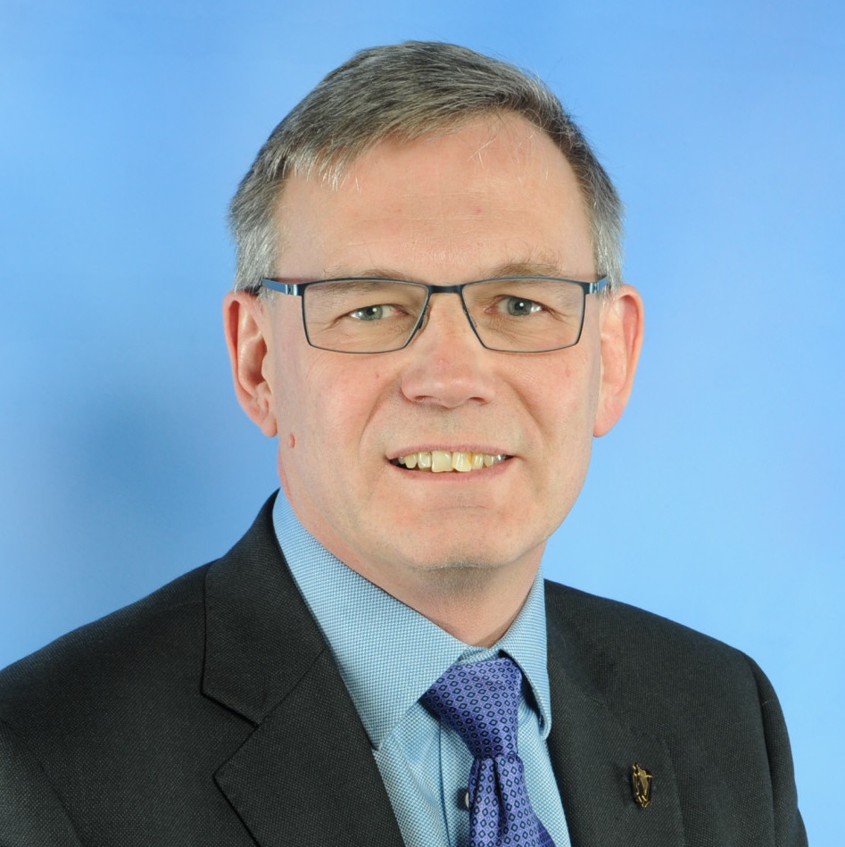
Mark Parker is a geophysicist and mineral exploration entrepreneur with 40 years’ experience in prospecting, consulting and corporate management in Africa, Europe, Southeast Asia, Latin America and the Middle East.
Mark was non-executive Chairman of International Geoscience Services Ltd (IGS) from January 2017 to January 2021 when he became a director.
Mark is founder and Managing Director of Equator Gold Limited, which explores for gold in South Sudan. He is also Chairman of Andiamo Exploration Ltd, a British company with gold and base metal VMS projects in Eritrea, and is a non-executive director of AIM-traded investor Blenheim Natural Resources plc. From 1996 to 2011, Mark was Managing Director of African Eagle Resources plc. Previously he worked for the British Geological Survey, Hunting Geology and Geophysics, Ark Geophysics and as a consultant. He holds a BA in Environmental Science from Lancaster University.
Ash Johnson is a geophysicist and business leader with over 30 years’ experience in research, global business development, leadership and corporate governance. Ash is the founder and director of Joluco Ltd, a geoscience business consulting company helping companies bridge the gap between science and business.
Ash started his career at the British Antarctic Survey, rising to Head of Airborne Geophysics and competing 5 Antarctic field seasons. He then spent more than 20 years at Geosoft Inc., a global geoscience software company, in various executive business leadership roles internationally. He served on the Board of Directors in Canada and the UK until the sale of the company in 2018. Ash currently serves as a Director of IDPeX Ltd, an Indian company partly owned by IGS.
He has degrees from York, Leeds and the Open University and holds a Diploma in Company Direction from the Institute of Directors
Christopher Duku is a trained Geologist/GIS specialist with a long experience in the use of geospatial data. He worked in different companies in the UK and the Netherlands including working for the Ministry of Petroleum and Mining Republic of South Sudan as Director of Mineral Exploration and Head of Mining Cadastre System.
Christopher is experienced in GIS data acquisition, data quality control and interpretation of Remote Sensing data. He has very good experience in the use of ESRI products including GIS software such as ArcGIS Pro, QGIS and MapInfo.
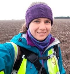
Rowan is an experienced mapping geologist with expertise in GIS-based digital geological mapping, structural geology and tectonics. She previously worked at the British Geological Survey leading an international mapping project and carrying out geological mapping and structural studies throughout the UK.
Much of her work focused on providing geological data and knowledge to the groundwater and renewable energy sectors, as well as creating products to inform natural hazard planning and management, and developing new digital geological mapping systems. With IGS, Rowan is conducting QC/QA of geological mapping in Saudi Arabia.
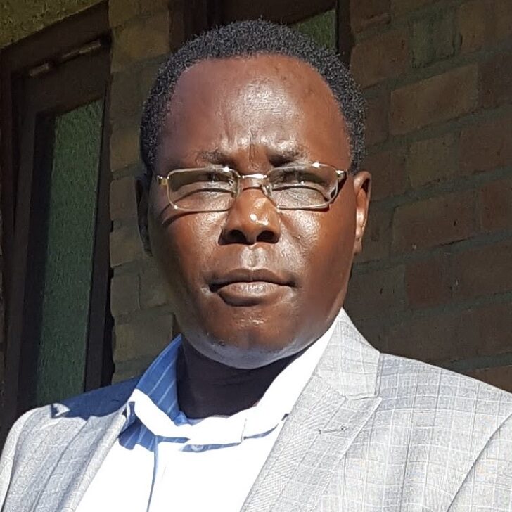
Mohammednur Ture is a geophysicist with over 35 years of experience in different fields and sub disciplines of geophysics which include among others the airborne geophysics, ground geophysics, magnetotellurics, geothermal, hydrocarbon and coal exploration, wireline logging and various methods of surveying and mapping.
Feargal manages large-scale airborne geophysical QA/QC projects at IGS, with recent work in Saudi Arabia, Nigeria, and India. He brings extensive field and interpretation experience, having spent over a decade with Sander Geophysics Ltd leading survey crews across the Americas, EAME, and Australasia, and playing a key role in the early commercial deployment of the Falcon gravity gradiometer and Sander AIRGrav systems. At ARKeX Ltd, he led multi-disciplinary interpretation projects integrating potential field, seismic, and geological data for hydrocarbon clients, and headed the interpretation department.
Feargal holds a 1st class BSc in Geophysical Science (UCD) and a PhD in Global Seismology (DIAS). Reflecting the growing intersection of geoscience and the energy transition, he also holds an MSc in Renewable Energy Systems Technology (Loughborough University), for which he received the Tony Marmont Prize for best graduating student.
Frik has more than 45 years of experience in geological work, especially in geological mapping, specializing in map compilation, international geological programs and institutional reform of National Geological Surveys, worldwide. He has previously worked for 33 years for the Council for Geoscience (South Africa) before joining IGS in 2014. He has also worked as an independent consultant to the minerals and mining community.
Frik has overseen several large international geological projects on behalf of funding agencies such as the World Bank, Islamic Bank, African Development Bank, Nordic Development Fund and various governments. He has worked with all the large geological surveys such as the BGS, BRGM, USGS, GTK, NGU, CGS (China), CGS (South Africa) and many other national geological surveys. He has worked in most of the SADC (Southern African Development Countries), as well as in projects in Mauritania, Madagascar, Mozambique, Cameroon, Uganda and Lao. Frik has also been involved in the institutional reform projects in the National Geological Surveys of Suriname, Algeria, Zambia and Malawi. Currently he is active in the various geologic projects been carried out in Saudi Arabia by the Saudi Geological Survey, where he has acted as Project Manager and Leader of the geological mapping component.
Frik Hartzer has a PhD degree from the University of Johannesburg, South Africa.
Assist national governments to implement large geodata mapping programmes to update and modernise their data holdings. This includes compiling terms of reference, implementing and supervising programmes and quality control monitoring.
ASSESSMENTS
Provide objective technical, financial and organisation assessments of governmental mineral support programmes through detailed scoping studies. We review and formulate policy and build capacity at technical and managerial levels.
MANAGE
Use and manage a large network of experienced geoscientists and project managers.
COMPILE RESOURCE
Compile mineral resource inventories, metallogenic and prospectivity maps.
COMPILE PROMOTION
Compile mineral promotion materials such as brochures and CDs at a regional and national scale to publicise prospective terrains for investors.
COMPILE PROMOTION
Develop geodata management systems to improve accessibility of geodata to the mineral exploration sector.
COMPILE PROMOTION
Build capacity in the geosciences at a technical and managerial level.
COMPILE PROMOTION
Provide expert advice and draw on experience of many national geological surveys to assist in restructuring, strategic review and implementing strategic plans.
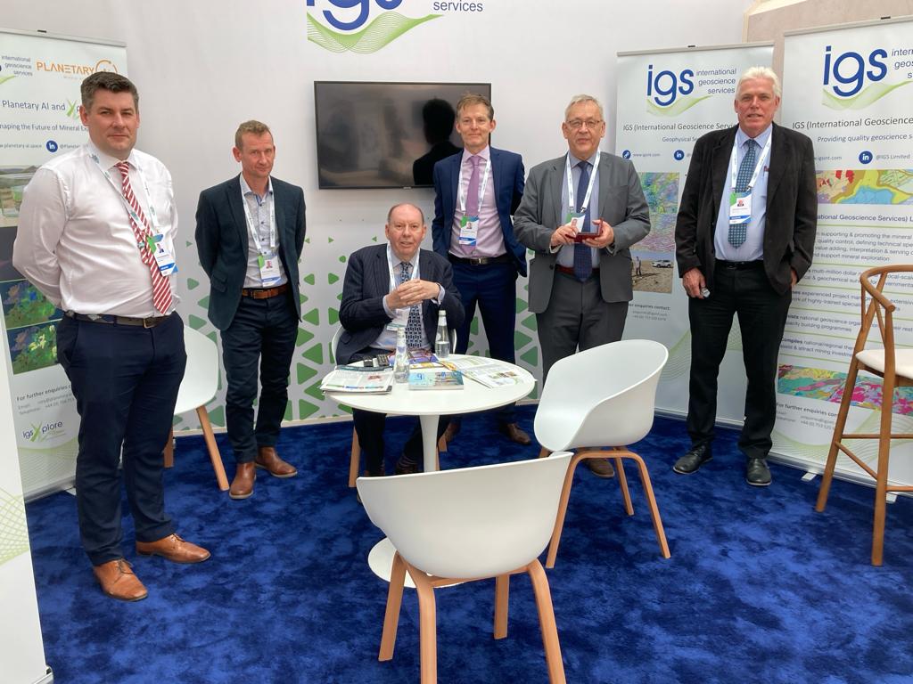
IGS Ltd: Specialists supporting and promoting the mineral resource sector