Following press release is courtesy of REMIT:
UK launches capacity building initiative for Geological Survey of Pakistan to strengthen mineral sector
Islamabad, April 16th 2026.
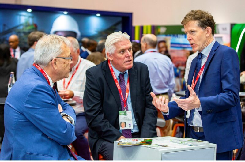
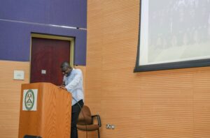
A UK-supported capacity building initiative aimed at strengthening Pakistan’s geoscientific capabilities and unlocking the country’s mineral potential was launched on Wednesday at the Geoscience Advance Research Laboratories (GARL), Islamabad.
The initiative, supported by the United Kingdom through its Foreign, Commonwealth and Development Office (FCDO) under the REMIT (Revenue Mobilisation, Investment and Trade) Programme, is being implemented in partnership with IGS (International Geoscience Services), a UK-based consultancy with extensive experience in supporting national geological survey organisations.
Federal Minister for Petroleum, Mr. Ali Pervaiz Malik, addressing the launching ceremony, underscored the importance of strengthening Pakistan’s geoscientific base to fully realise the potential of the mineral sector. He noted that the global shift towards clean energy has increased the importance of minerals, and Pakistan, with its established geological potential, offers strong opportunities for responsible investment. He reiterated the Government’s commitment to developing the sector in a sustainable, transparent and investor-friendly manner.
British High Commissioner, Ms. Jane Marriott CMG OBE, said that Pakistan possesses significant geological potential, which can be unlocked through credible and modern geoscientific data. She noted that the UK is supporting Pakistan in building the technical capacity and systems required to attract responsible investment and achieve long-term economic growth.
Director General, Geological Survey of Pakistan, Mr. Adnan Alam Awan, thanked the Government of the United Kingdom for the timely support and highlighted ongoing reform initiatives within GSP, including digitisation of legacy geoscientific data, initiation of new geophysical surveys, and human resource development measures. He noted that the present initiative under the FCDO-supported framework would significantly contribute towards achieving these institutional goals.
The DG GSP also recalled the contributions of British geoscientists who led the organisation in its early years after independence and laid a strong scientific foundation. He noted that initiatives such as the Commonwealth Colombo Plan reconnaissance geological mapping continue to serve as an important reference for geological work in Pakistan.
The programme will run from April to July 2026 and focuses on strengthening the technical capability of GSP through hands-on training aligned with international standards. The training will cover key areas including digital geological surveying, geochemical sampling, airborne geophysics and Geographic Information Systems (GIS), enabling the development of an end-to-end digital geological survey process from fieldwork to final mapping outputs.
The initiative is expected to enhance GSP’s ability to independently design and execute national-level surveys to internationally acceptable standards, thereby improving data quality and investor confidence in Pakistan’s mineral sector.
The launch event was attended by senior representatives from the Government of Pakistan, including senior officials and representatives of IGS (International Geoscience Services), who joined virtually.
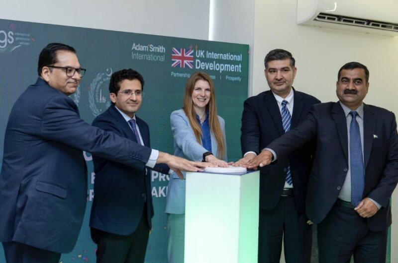
From left: Mr. Hamid Yaqub Sheikh (Secretary, Ministry of Energy, Petroleum Division); Mr. Ali Pervaiz Malik (Federal Minister for Petroleum); Ms. Jane Marriott CMG OBE (British High Commissioner); Dr Hamid Ashraf (Team Lead, Mineral Cell (Harmonization of Mineral Sector), Petroleum Division, & Advisor to Geological Survey of Pakistan); Mr. Adnan Alam Awan (Director General, Geological Survey of Pakistan)
(For more information please contact us at enquiries@igsint.com)
Professor Garth Earls, Peter Zawada and Christoph Dobmeier attended PDAC 2026 in Toronto, Canada. As usual it was great to meet up with colleagues, friends and partners from the mining sector. The country focused sessions were particularly informative.

Professor Garth Earls and Dr. Peter Zawada at PDAC 2026
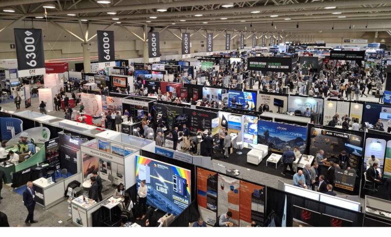
PDAC 2026 in Toronto, Canada
(For more information please contact us at enquiries@igsint.com)
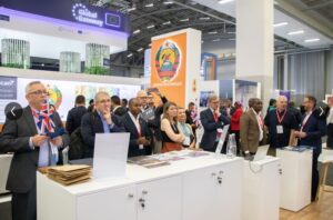
Inadab 2026 generated many productive discussions for IGS, with colleagues and clients old and new.
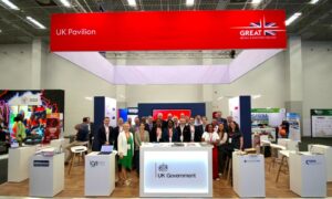
IGS was part of the UK pavilion. A key takeaway was the glaring need to ramp up critical mineral (particularly copper) discoveries and mine development.
A key input – pre-competitive geo-data – was the theme of most of our discussions & meetings.
IGS team at mining INDABA 2026, from left Dr Peter Zawada, Dr. Frik Hartzer and Dr Feargal Murphy
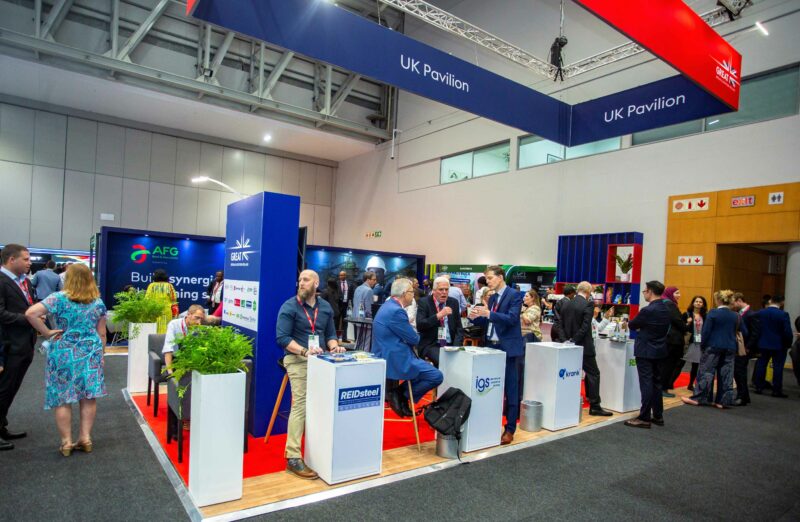
UK Pavilion at mining INDABA 2026
IGS team at mining INDABA 2026
(For more information please contact us at enquiries@igsint.com)
It was a pleasure for IGS to exhibit at the Hub of Excellence as part of FMF 26 in Riyadh, Saudi Arabia. Our stand was busy with visitors and of particular interest. There was increase level of interest from KSA’s junior exploration sector. Once again it was great to meet with current and prospective clients from many countries.
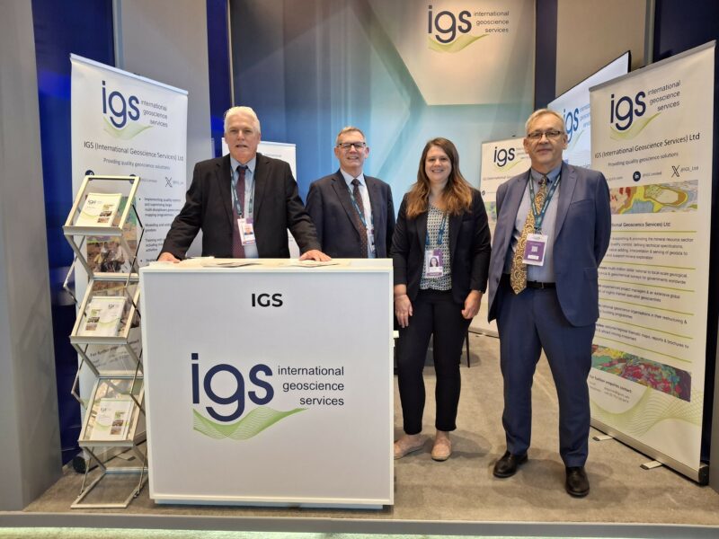
IGS team at FMF26 in Riyadh, from right Dr. Peter Zawada, Dr. Rowan Vernon, Dr. Ashley Johnson and Dr. Frik Hartzer
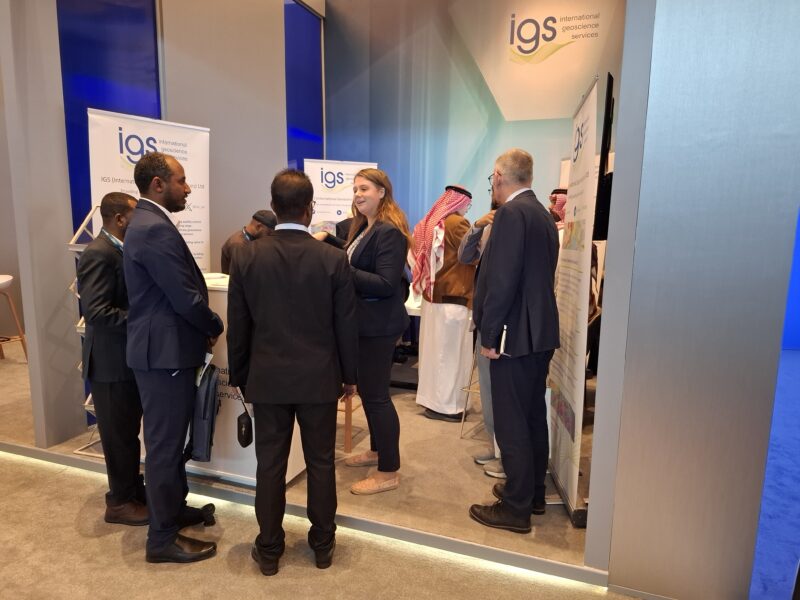
Dr. Rowan speaking with visitors at our stand in the Hub of Excellence at FMF26 in Riyadh
(For more information please contact us at enquiries@igsint.com)
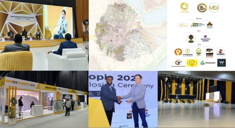
The geological institute of Ethiopia and the Federal Democratic Republic of Ethiopia (FDRE) Ministry of Mines invited IGS to present at Mintex 2025 on the multi-sector applications of regional airborne geophysics.
The many insightful questions reinforced the importance of expanding pre-competitive geoscience data in Ethiopia—especially across the Neoproterozoic terranes and regions with high geothermal potential.
Dr. Feargal Murphy of IGS was pleased to attend and contribute to such an engaging conference and trade show. The range of topics — from mineral policy and legal frameworks to artisanal mining, new exploration activity, and recent mine developments — made for an informative and productive event.
Dr. Feargal Murphy presenting at Mintex 2025
(For more information please contact us at enquiries@igsint.com)
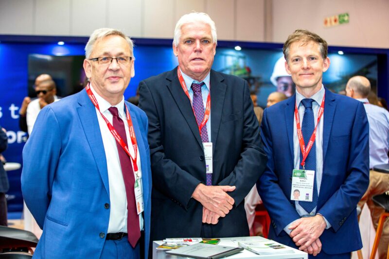
Feargal Murphy and Rowan Vernon each presented updates on IGS’s work on the Saudi Geological Survey Regional Geoscience Program (RGP) at GEOMIN 2025 on the 13th and 14th October 2025.
The conference brought together 500 attendees and over 100 presentations. There were many presentations showcasing the fantastic geophysical and geochemical datasets released on the National Geoscience Portal (NGD).
Rowan presented updates on the Geological Mapping of the Arabian Shield (GMAS) project; supporting the discovery of New Mineral Resources. The initial products of the work are expected for release on the NGD in early 2026.
Feargal’s presentation covered examples of how the Phase 1 RGP airborne geophysics (magnetic and radiometric data) can be used for exploration with a focus on using open-source tools for data visualisation and enhancement.
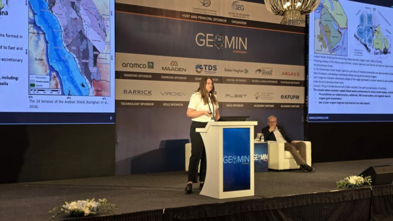
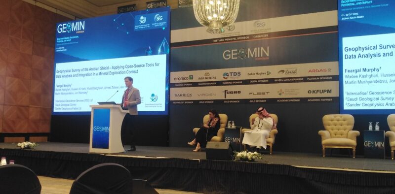
Feargal and Rowan presenting at GEOMIN 2025 in Saudi Arabia
(For more information please contact us at enquiries@igsint.com)
Dr Christoph Dobmeier, Senior Specialist Geoscientist at IGS participated in the Mauritanides 2025 conference and exhibition which took place in Nouakchott between 8th and 10th September.
The meeting focused on the rich mineral and Oil & Gas endowments as well as the clean energy sector (“green hydrogen”). The show is the most important platform in North-West Africa for the mining and energy sectors.
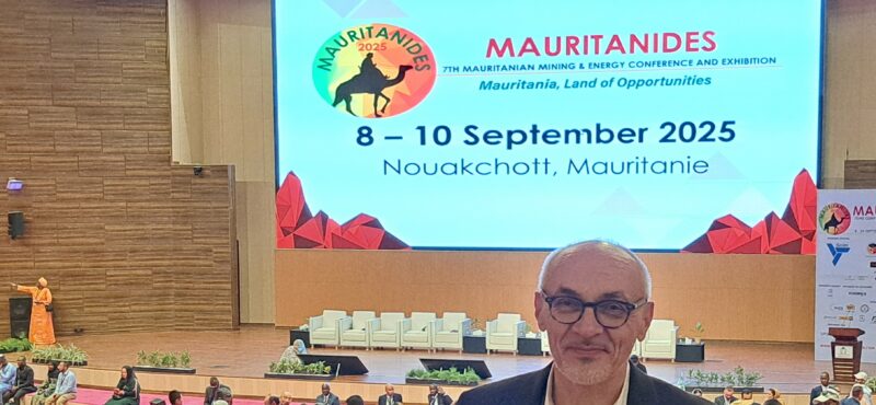
Dr Christoph Dobmeier participating in the Mauritanides 2025 conference
(For more information please contact us at enquiries@igsint.com)
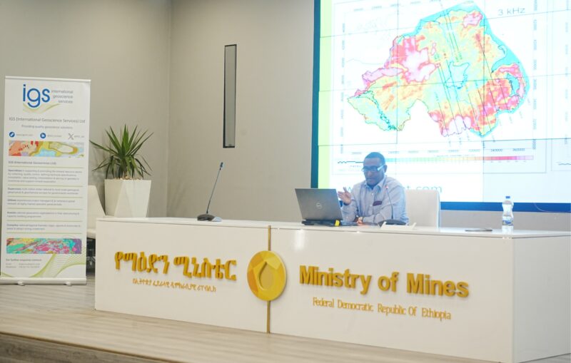
IGS recently delivered a workshop on airborne geophysics at the Geological Institute of Ethiopia.
The workshop was delivered by Dr Feargal Murphy and Mohammednur Ture who presented over three days on the main techniques and the benefits of airborne surveys to acquire pre-competitive data.
The sessions were eagerly received by geoscientists from the Geological Institute, Ministry of Mines, Addis Ababa University, and Ethiopian Geosciences and Mineral Engineering Association. Material covered included planning regional surveys, the applications of various methods and the expected benefits with examples from IGS’s portfolio of experience in pre-competitive geoscience programmes.
The presentations included examples spanning mineral exploration, geothermal, hydrocarbons and environmental applications. An extended and highly engaged Q&A session proved the strong cross sectoral geoscience experience amongst local geoscientists.
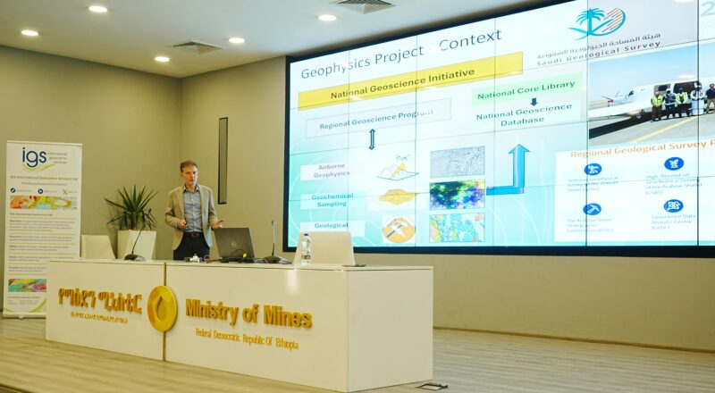
Dr. Feargal Murphy delivering a presentation
Mr. Mohammednur Desissa Ture delivering a presentation
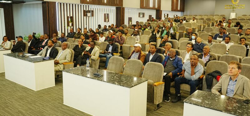
Geoscientists from the Geological Institute, Ministry of Mines, Addis Ababa University and Ethiopian Geosciences and Mineral Engineering Association attending the workshop.
(For more information please contact us at enquiries@igsint.com)
Dr. Christoph Dobmeier, Senior Specialist Geoscientist at IGS, speaking at a technical session at the EMF 2025 (Egypt Mining Forum 2025) in Cairo on the importance of data quality for geological surveys and presenting latest updates on the Regional Geoscience Program (RGP), which is one of the initiatives of Saudi Arabia’s Vision 2030. IGS is the Technical Partner to the Saudi Geological Survey for this programme.
EMF brings together professionals from the mining and exploration industries and has a strong focus on the Arabian-Nubian Shield.
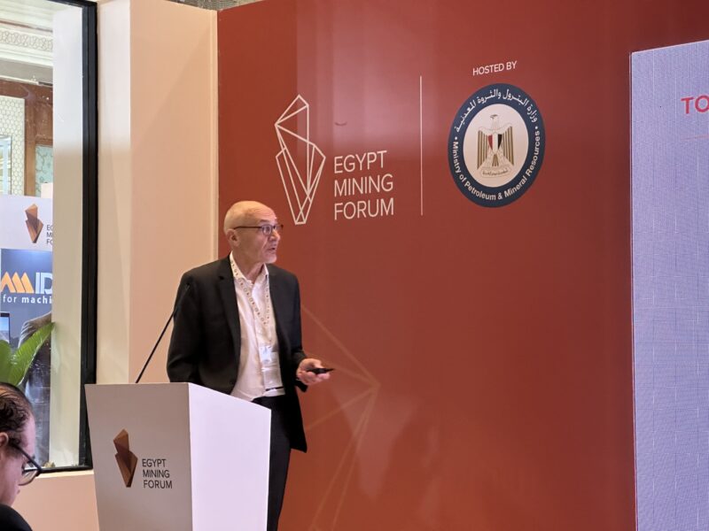
Dr. Christoph Dobmeier speaking at a technical session at Egypt Mining Forum 2025 in Cairo
(For more information please contact us at enquiries@igsint.com)
IGS (International Geoscience Services) Ltd, a leading provider of earth-based intelligence to governments worldwide, is delighted to collaborate with GeoOptimist to advance mineral exploration and geological mapping services. This collaboration brings together complementary strengths in geology, remote sensing, and geospatial analysis, enhancing both companies’ capabilities in mineral targeting and resource evaluation.
Together, we offer proven expertise in delivering high-quality data and geospatial insights that support and enrich geological investigations in the following areas:
Geological Mapping
Advanced image processing techniques—including custom band combinations and mineralogical band ratios—to highlight key lithologies and mineral distributions. Multispectral and hyperspectral data are used to map geological formations, locate potential mineral deposits and interpret surface geology.
Advanced Image Processing
Data reduction methods, including Principal Component Analysis (PCA), and classification approaches—both supervised and unsupervised—are used to enhance feature extraction. These techniques support improved lithological interpretation and structural analysis.
GIS Data Management and Map Production
Comprehensive GIS support includes data creation, cleaning, database structuring and managing, and metadata documentation. High-quality, client-specific map products are produced using standardized workflows and robust spatial data management.
QA/QC in Remote Sensing
A systematic QA/QC process ensures the accuracy and consistency of remote sensing data and preprocessing steps. These quality measures are critical for delivering reliable inputs to geological mapping and exploration workflows.
This collaboration blends strong geological expertise with technical excellence in geospatial science. Our combined capabilities offer a reliable and flexible resource for exploration teams and government agencies seeking trusted geoscience support.
(For more information please contact us at enquiries@igsint.com)
Kwesi Apiah of IGS, delivered a presentation on the high-resolution geochemical survey of the Arabian Shield: methods, results, outlook and assessment of its lithium potential. The workshop, organised by the Exploration Centre of the Saudi Geological Survey (SGS), was held in Jeddah on 10 February, 2025. The primary focus was on lithium exploration within the diverse geological environments of the Arabian Shield.
The event featured geoscientific presentations from experts at SGS, IGS (Technical Partner for the Geochemical Sampling Project), King Abdulaziz University, international institutions and industry. The workshop aimed to foster knowledge exchange on lithium exploration, analytical methods, interpretation of results and innovative extraction methods used globally.
Kwesi Apiah of IGS presenting at the workshop on Lithium Exploration for a Sustainable Future in Jeddah, Saudi Arabia
(For more information please contact us at enquiries@igsint.com)
IGS attended the Mining Indaba 2025 in Cape Town from 3rd – 6th February as part of the UK Government Pavilion. The IGS team included Peter Zawada, Ash Johnson and Frik Hartzer.
Mining Indaba was particularly successful this year based on the many lines of interest shown in IGS from Governments, Geological Surveys, AI/Data companies and the exploration sector.
Many thanks to the UK Trade Delegation for their efforts in making the UK presence in the sector a strong one.
IGS and other UK companies showcasing at the UK Pavilion at INDABA in Cape Town, South Africa.
Dr Peter Zawada and colleagues from the other UK companies.
(For more information please contact us at enquiries@igsint.com)