GIS and Remote Sensing
IGS is working in Collaboration with GeoOptimist
IGS (International Geoscience Services) Ltd, a leading provider of earth-based intelligence to governments worldwide, is delighted to collaborate with GeoOptimist to advance mineral exploration and geological mapping services. This collaboration brings together complementary strengths in geology, remote sensing, and geospatial analysis, enhancing both companies’ capabilities in mineral targeting and resource evaluation.
Together, we offer proven expertise in delivering high-quality data and geospatial insights that support and enrich geological investigations in the following areas:
Geological Mapping
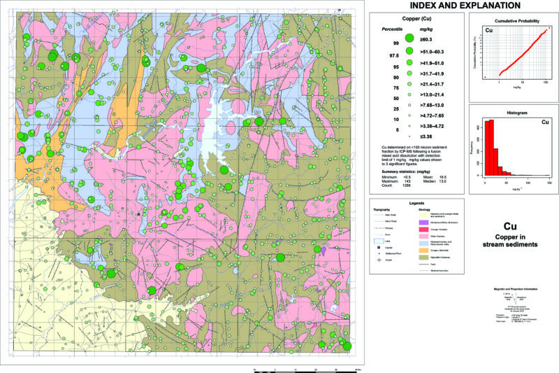
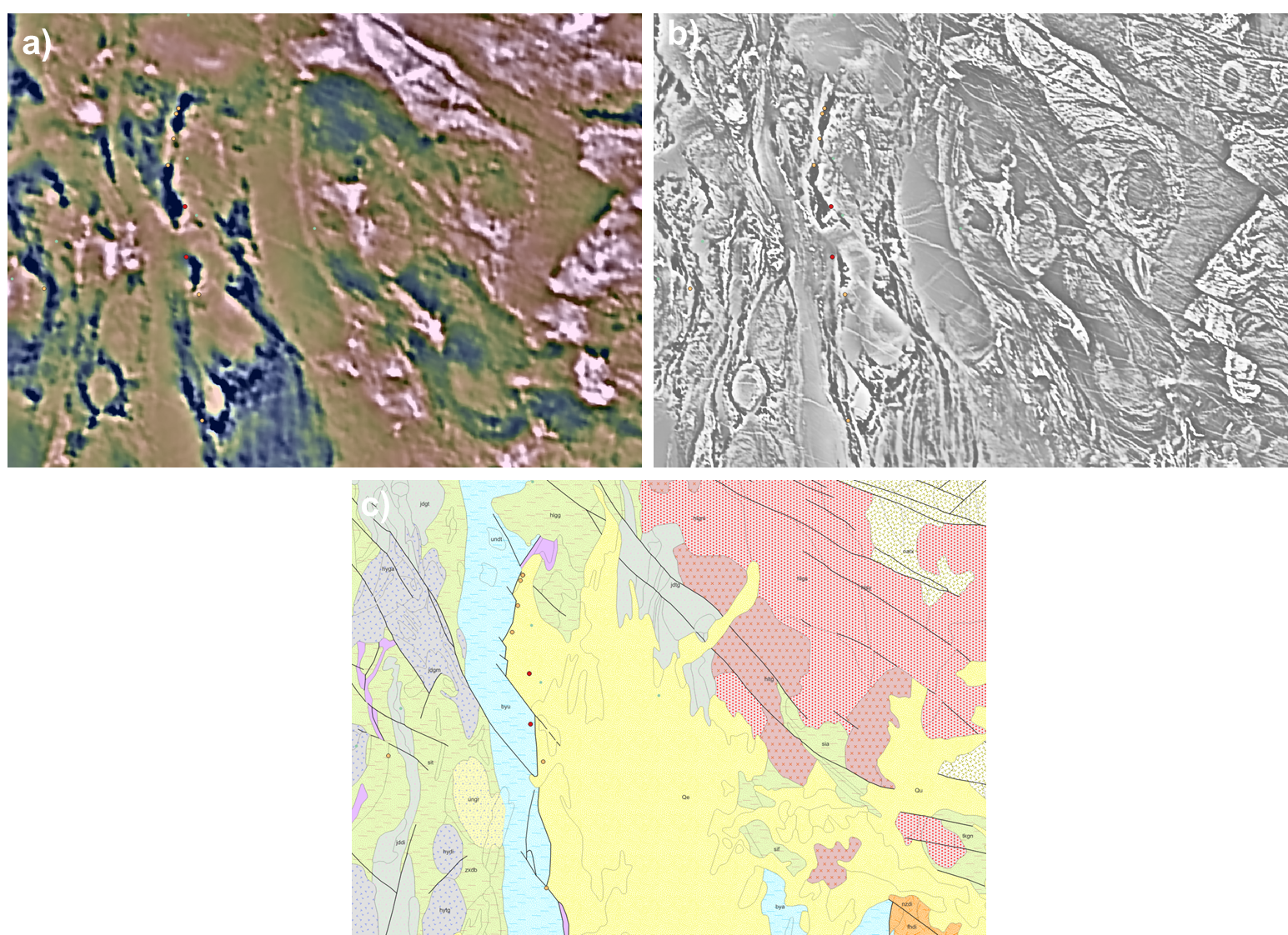
Advanced image processing techniques—including custom band combinations and mineralogical band ratios—to highlight key lithologies and mineral distributions. Multispectral and hyperspectral data are used to map geological formations, locate potential mineral deposits and interpret surface geology.
Advanced Image Processing
Data reduction methods, including Principal Component Analysis (PCA), and classification approaches—both supervised and unsupervised—are used to enhance feature extraction. These techniques support improved lithological interpretation and structural analysis.
GIS Data Management and Map Production
Comprehensive GIS support includes data creation, cleaning, database structuring and managing, and metadata documentation. High-quality, client-specific map products are produced using standardized workflows and robust spatial data management.
QA/QC in Remote Sensing
A systematic QA/QC process ensures the accuracy and consistency of remote sensing data and preprocessing steps. These quality measures are critical for delivering reliable inputs to geological mapping and exploration workflows.
This collaboration blends strong geological expertise with technical excellence in geospatial science. Our combined capabilities offer a reliable and flexible resource for exploration teams and government agencies seeking trusted geoscience support.