Following press release is courtesy of REMIT:
UK launches capacity building initiative for Geological Survey of Pakistan to strengthen mineral sector
Islamabad, April 16th 2026.
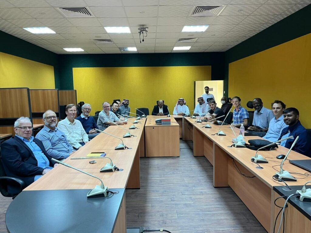
A UK-supported capacity building initiative aimed at strengthening Pakistan’s geoscientific capabilities and unlocking the country’s mineral potential was launched on Wednesday at the Geoscience Advance Research Laboratories (GARL), Islamabad.
The initiative, supported by the United Kingdom through its Foreign, Commonwealth and Development Office (FCDO) under the REMIT (Revenue Mobilisation, Investment and Trade) Programme, is being implemented in partnership with IGS (International Geoscience Services), a UK-based consultancy with extensive experience in supporting national geological survey organisations.
Federal Minister for Petroleum, Mr. Ali Pervaiz Malik, addressing the launching ceremony, underscored the importance of strengthening Pakistan’s geoscientific base to fully realise the potential of the mineral sector. He noted that the global shift towards clean energy has increased the importance of minerals, and Pakistan, with its established geological potential, offers strong opportunities for responsible investment. He reiterated the Government’s commitment to developing the sector in a sustainable, transparent and investor-friendly manner.
British High Commissioner, Ms. Jane Marriott CMG OBE, said that Pakistan possesses significant geological potential, which can be unlocked through credible and modern geoscientific data. She noted that the UK is supporting Pakistan in building the technical capacity and systems required to attract responsible investment and achieve long-term economic growth.
Director General, Geological Survey of Pakistan, Mr. Adnan Alam Awan, thanked the Government of the United Kingdom for the timely support and highlighted ongoing reform initiatives within GSP, including digitisation of legacy geoscientific data, initiation of new geophysical surveys, and human resource development measures. He noted that the present initiative under the FCDO-supported framework would significantly contribute towards achieving these institutional goals.
The DG GSP also recalled the contributions of British geoscientists who led the organisation in its early years after independence and laid a strong scientific foundation. He noted that initiatives such as the Commonwealth Colombo Plan reconnaissance geological mapping continue to serve as an important reference for geological work in Pakistan.
The programme will run from April to July 2026 and focuses on strengthening the technical capability of GSP through hands-on training aligned with international standards. The training will cover key areas including digital geological surveying, geochemical sampling, airborne geophysics and Geographic Information Systems (GIS), enabling the development of an end-to-end digital geological survey process from fieldwork to final mapping outputs.
The initiative is expected to enhance GSP’s ability to independently design and execute national-level surveys to internationally acceptable standards, thereby improving data quality and investor confidence in Pakistan’s mineral sector.
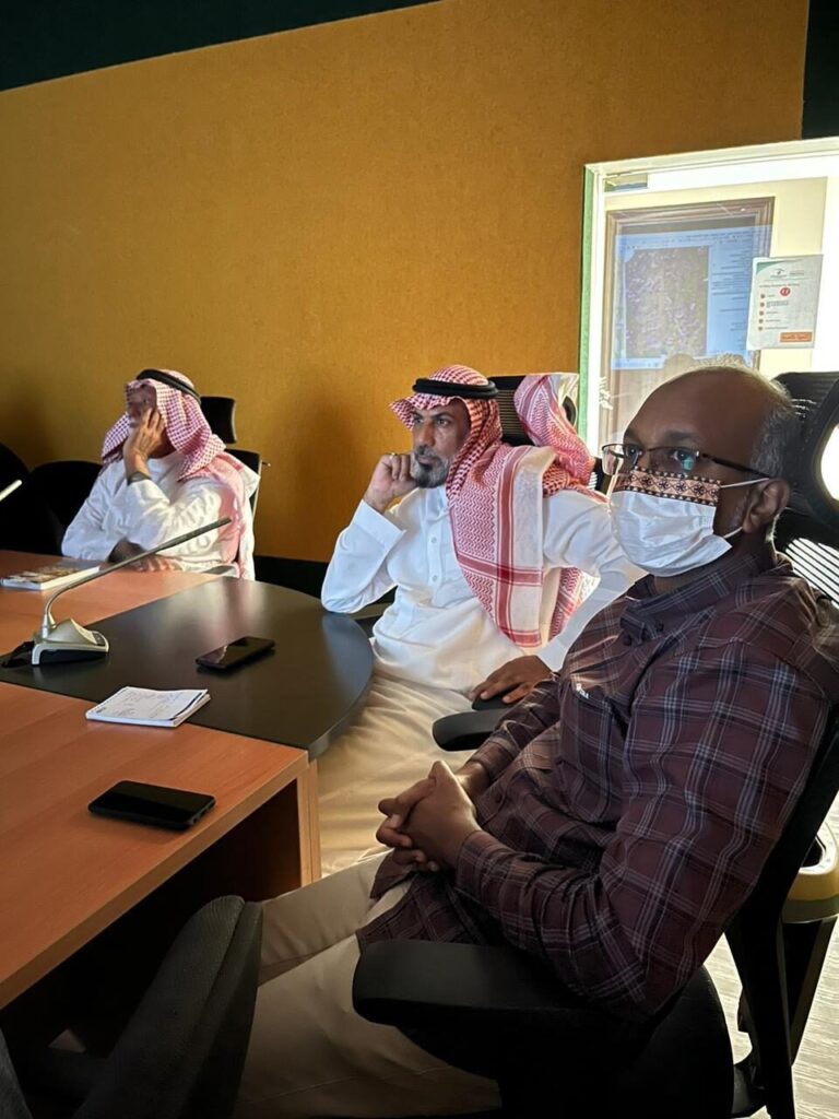
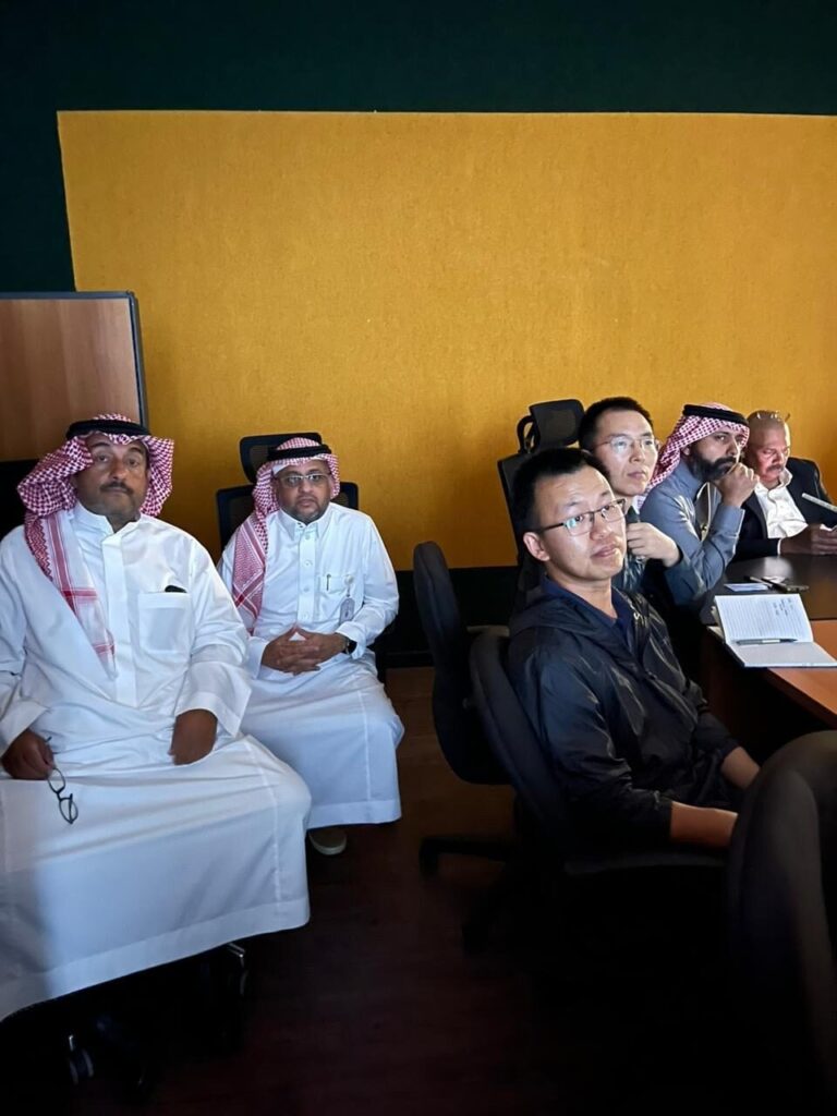
The launch event was attended by senior representatives from the Government of Pakistan, including senior officials and representatives of IGS (International Geoscience Services), who joined virtually.
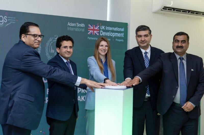
From left: Mr. Hamid Yaqub Sheikh (Secretary, Ministry of Energy, Petroleum Division); Mr. Ali Pervaiz Malik (Federal Minister for Petroleum); Ms. Jane Marriott CMG OBE (British High Commissioner); Dr Hamid Ashraf (Team Lead, Mineral Cell (Harmonization of Mineral Sector), Petroleum Division, & Advisor to Geological Survey of Pakistan); Mr. Adnan Alam Awan (Director General, Geological Survey of Pakistan)
(For more information please contact us at enquiries@igsint.com)
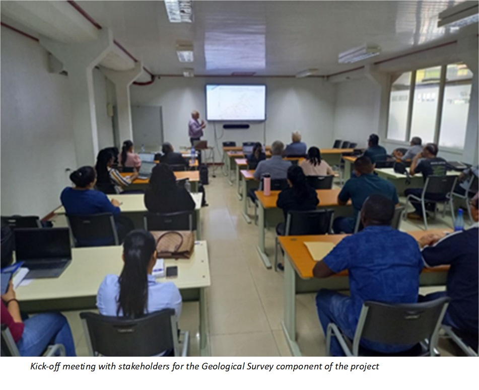
IDPeX and MSA have been working together on a project for OMC (Odisha Mining Corporation Limited) to provide exploration related support and technical assistance for mining blocks in Odisha, to be auctioned by the State Government.
IDPeX is an Indian registererd consultancy that brings together the resources of IGS, PGW and Datacode. MSA is the contractual lead on the project and brings its valuable experience in mineral exploration. Because we all attended the Future Minerals Forum 24, in Riyadh, we took the opportunity to meet after FMF 24 to discuss progress on the project and to agree on further planning. A successful meeting and many thanks to all who attended.
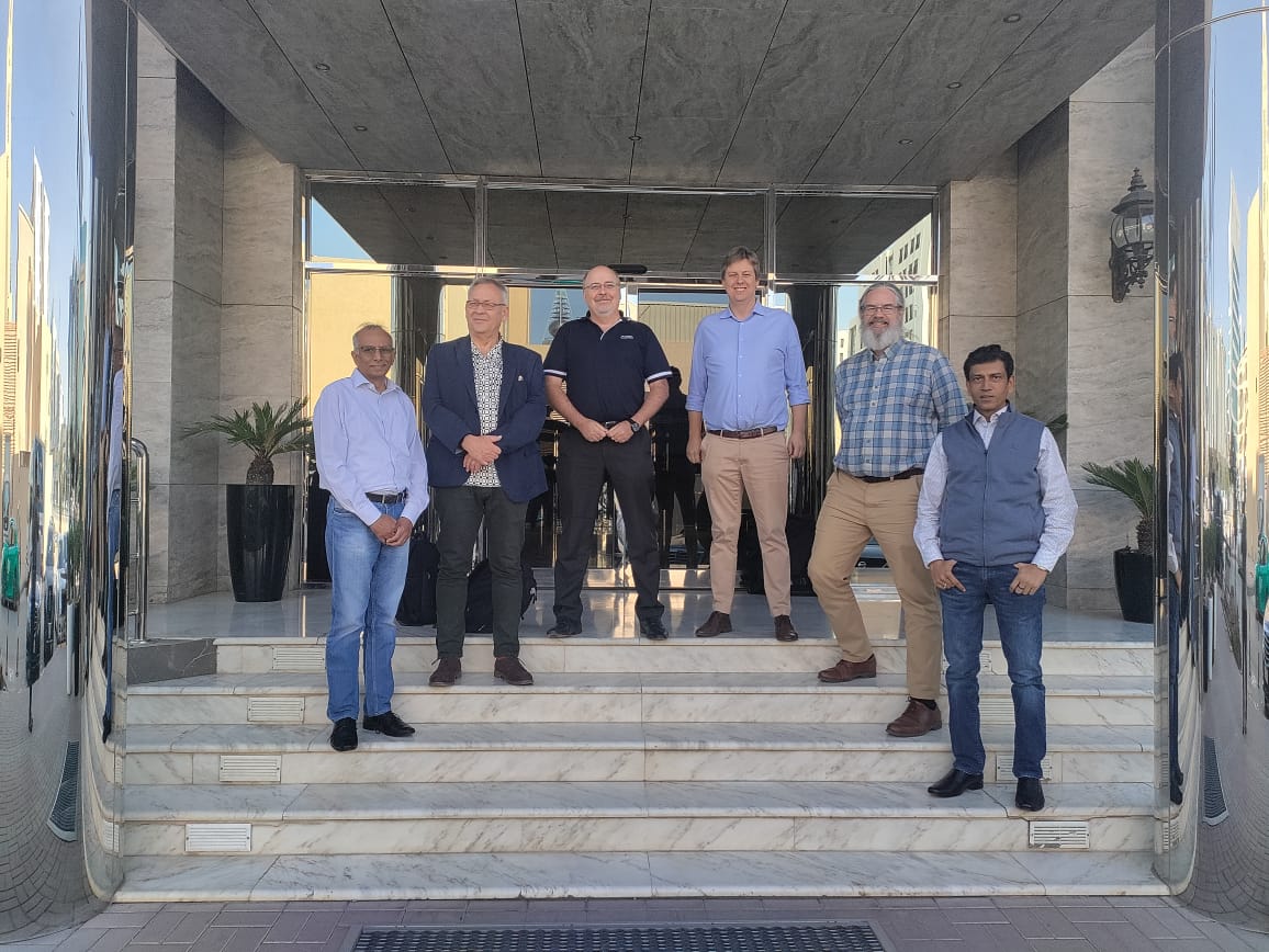
By Dr. Peter Zawada – Managing Director
(For more information please contact us at enquiries@igsint.com)
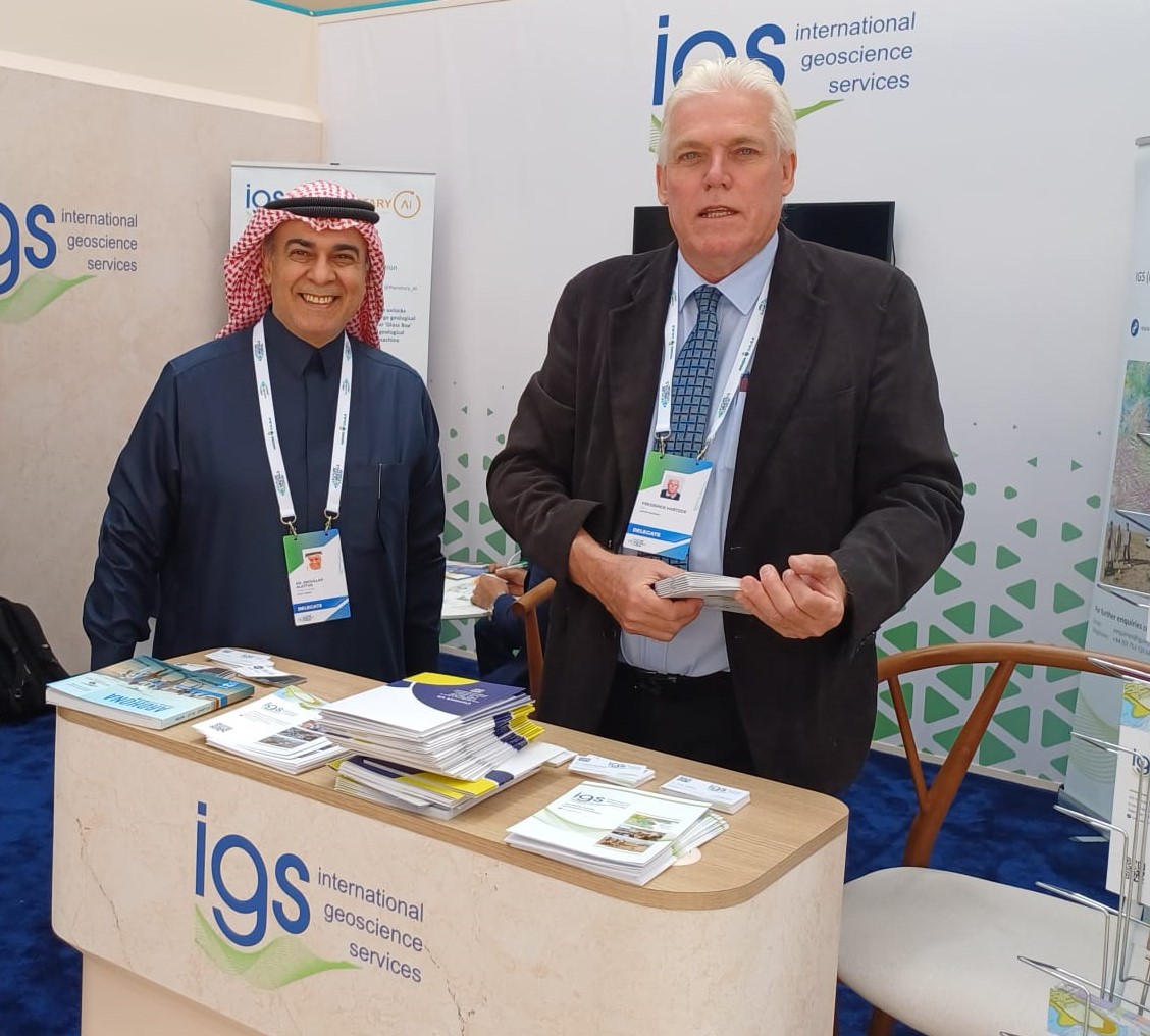
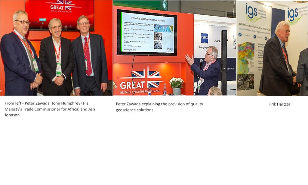
IGS attended the Future Minerals Forum 24 (FMF 24), in Riyadh (9-11 January 2024). IGS had its own stand and was attended by Garth Earls, Peter Zawada, Frik Hartzer and Feargal Murphy of IGS. FMF 24 was a great success for us and enabled the company to establish its position as an important geoscientific consultancy operating in the Kingdom.
It was a pleasure and honour to meet so many interested colleagues from the Kingdom and be part of an ever growing, developing and dynamic mineral sector. Our colleagues from Planetary AI also attended and had valuable discussions on the mineral prospectivity software, Xplore.
It was once again a pleasure to host Geotech Arabia, our partner for the Technical Partner project with the Saudi Geological Survey. IGS sees FMF 24 as an important global and regional event that serves the mineral sector, which we expect to grow from strength to strength, and accordingly, we plan to exhibit and attend FMF 25, next year.
-
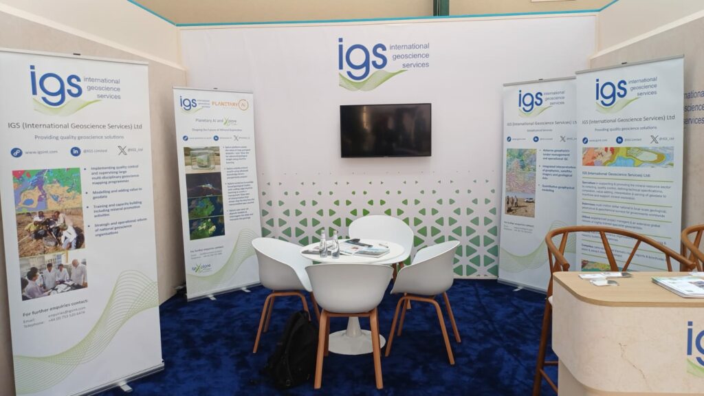
IGS Stand at FMF24
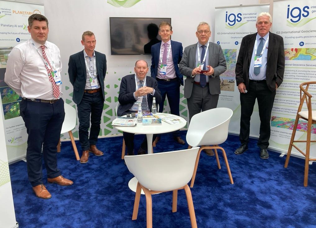
From left: Gavin Berkenheger & Rory Somerset of Planetary AI; Garth Earls, Feargal Murphy, Peter Zawada & Frik Hartzer of IGS
By Dr. Peter Zawada – Managing Director
(For more information please contact us at enquiries@igsint.com)
As part of the preparation for the mobile digital mapping of the Arabia Shield, the contractor (China Geological Survey) presented a beta version of its self-developed mobile application. At a two-day workshop in Jeddah, geologists from the Saudi Geological Service (SGS) and IGS geologists as Technical Partner of SGS were able to get an introduction of how the software can be used in the field. Based on experiences made in the field and input by SGS and TP, the contractor aims to optimize on the mobile mapping application.
Geological Mapping of the Arabian Shield – Contractor presents Mobile Mapping Application
By Dr. Reik Degler – Project Geologist
(For more information please contact us at enquiries@igsint.com)
Dr Esko Korkiakoski, the new IGS Team Leader for the Geochemical Survey of Arabian Shield (GSAS) gave the opening presentation at a recent two day open session workshop held at Swissôtel Living Jeddah Hotel on 17-18 of September 2023. He outlined the current status and objectives of the survey. During the session of the workshop, China Geological Survey (CGS) (the technical operator of the field sampling, analytical work and map production) presented about 90,000 stream sediment samples.
IGS Ltd and Geological Survey of Finland (GTK) are technical partners to Saudi Geological Survey (SGS). They are in charge of the quality control of the geochemical survey, giving support and advice in all aspects related to the project implementation, and approval of the final products.
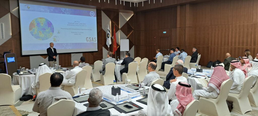
By Dr. Esko Korkiakoski (IGS Ltd) – Technical Partner team leader for the SGS Geochemical Survey of Arabian Shield (GSAS)
(For more information, please contact us at enquiries@igsint.com)
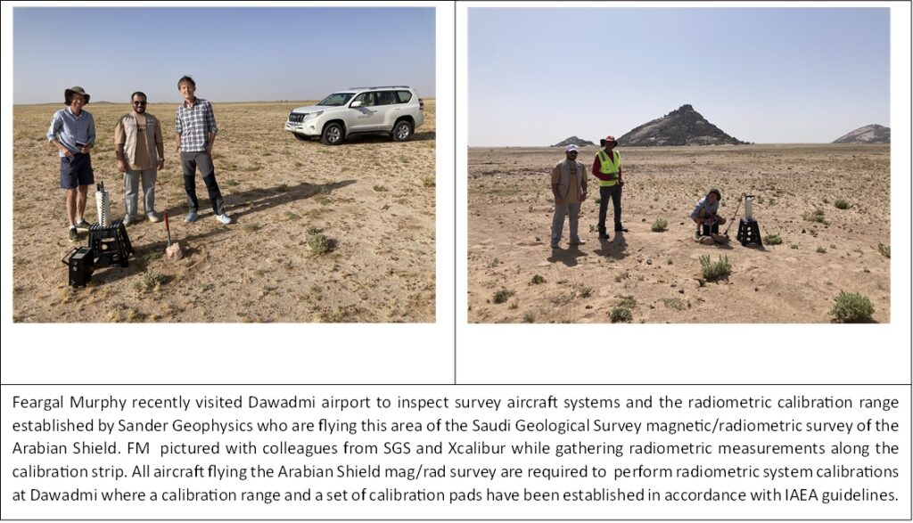
Dr Feargal Murphy recently presented initial results from SGS RGP airborne geophysics phase 1 (mag/rad) to experts from Arabian Shield Stratigraphic Commission (ASSC) group. The ASSC is a panel of international experts in Neoproterozoic geology who are developing an updated lithostratigraphy for the upcoming Arabian Shield mapping programme. The RGP phase 1 data is being acquired for SGS by Sander Geophysics Ltd and Xcalibur Multiphysics. IGS and colleagues from Patterson Grant and Watson (PGW) are technical advisors for the RGP geophysics programmes. IGS and GTK are technical partner for the RGP programme.
By Dr. Feargal Murphy – principal geophysicist
(For more information please contact us at enquiries@igsint.com)
IGS and GAF AG (Germany) are together working on a 12-month long project commissioned by the Suriname Ministry of Natural Resources entitled: ‘International mining specialist to support the establishment & the commissioning of the Minerals Institute of Suriname: Cadastre & Geological Survey’. This is one of several initiatives of a loan agreement between Suriname and the World Bank called the ‘Suriname Competitiveness and Sector Diversification Project’.
Suriname has an interesting geology with much of it located on the Guiana Shield, which has a high potential for a range of minerals including gold, diamonds, other metallic minerals as well as kaolin, critical minerals (including rare earth elements) and dimension stone. The extractive sector of Suriname is dominated by oil, gold and bauxite. The government wants to promote a regulated and responsible expansion of its mining industry by creating a new mining authority known as ‘Delfstoffen Authoriteit Suriname’, whose objective will be the promotion, coordination, regulation, monitoring and inspection of its mineral sector in a sustainable manner. Our project supports these objectives by developing a modernised mining cadastre and a new Geological Survey.
IGS is responsible for the development and early-stage implementation of a road map for a new Geological Survey. An important component of the work will be to identify the key geoscience and geodata programs that will attract investor interest in the country. GAF AG is responsible for the assessment and development of a road map for the implementation of a revised and modernised cadastre system. Both IGS and GAF AG have visited the country as part of the inception phase and are now working on the assessment part of the project for these components. Further updates for this project will be posted as the project progresses.
(For more information please contact us at enquiries@igsint.com)
On another note, IGS has continued to perform quality control on the MINDIVER airborne geophysics program in Nigeria. IGS is sub-contracted by PGW of Toronto. IGS geophysicists have recently completed quality control of ~190,00 line kms of airborne magnetic/radiometric data.
By Dr. Feargal Murphy – principal geophysicist
(For more information please contact us at enquiries@igsint.com)
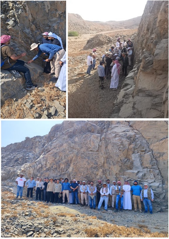
IGS and its partners are honoured to have attended the official opening ceremony of the Arabian Shield Geological Mapping (GMAS) project. The event took place near Jeddah on Sunday May 28th 2023. The official launch of the project was marked by speeches from the Minister of Industry and Mineral Resources, Bandar Alkhorayef and the Chairman of the Chinese Geological Survey, Li Jianxing. Many geologists from the Saudi Geological Survey, the contractor (China Geological Survey) and the Technical Partner (IGS-GTK Consortium) attended the ceremony.
For the GMAS project, IGS as lead Technical Partner is the official technical adviser for the Saudi Geological Survey and is responsible for the supervision and quality control. For more information see : https://www.arabnews.com/node/2312236/business-economy
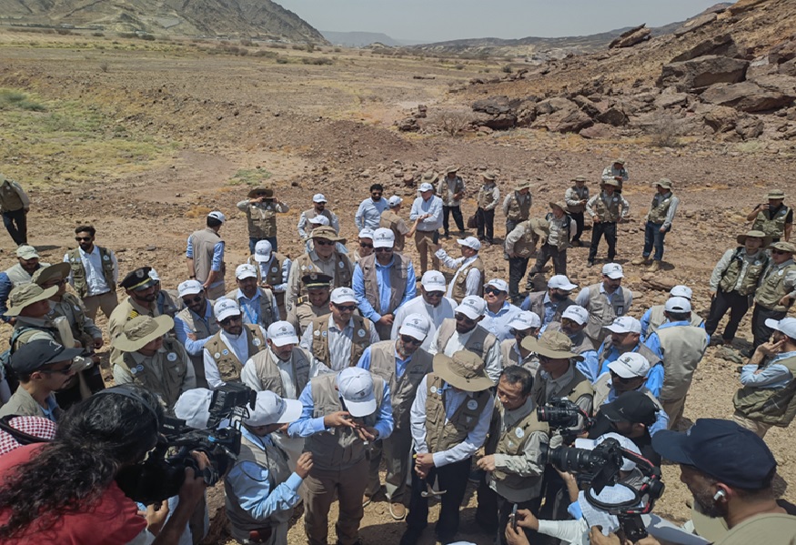
Geologists from the Saudi Geological Survey (SGS), Chinese Geological Survey (CGS) and the Technical Partner (TP) as part of the official opening ceremony of the Geological Mapping project of the Arabian Shield, Saudi Arabia.
By Dr. Reik Degler – Project Geologist
(For more information please contact us at enquiries@igsint.com)
IGS as leader of the Technical Partner Consortium to the Saudi Geological Survey participated in the Kick-off meeting (KOM) for project Geological Mapping of the Arabian Shield, which is part of the Regional Geoscience Program (RGP), executed under the leadership of the Saudi Geological Survey. The meeting, which was organized by the contractor China Geological Survey (CGS) and its logistics partner China National Geological & Mining Corporation (CGM), took place from 19-21 March 2023 at Aliaa Swissotel Living Hotel in Jeddah with some 50 delegates from seven nations.
With 15 presentations, the contractor explained how the 11-year project should be implemented. The objective is to improve the geological knowledge of the Arabian Shield, which covers some 650,000 square kilometers, by generating a new set of geological maps. 257 maps at a scale of 1:100,000 are required. The maps will be based on new geological field surveys (undertaken at a scale of 1:50,000) including analytical work, the results of currently operational airborne geophysical and ground-based geochemical (stream sediment) surveys, an updated lithostratigraphic framework, and legacy data.
IGS is responsible for the supervision of all works and quality control of all products of project Geological Mapping of the Arabian Shield.
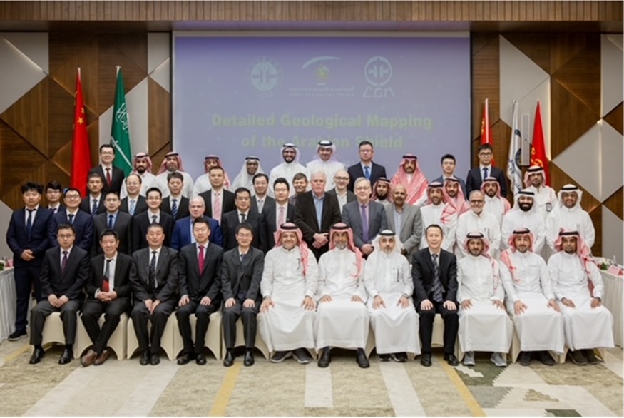
Group photo of KOM delegates. The CEO of SGS, Engineer Abdullah bin Muftar Al-Shamrani sits in the centre of the bottom row, flanked by the project owner Dr Wadee Kashghari (left) and Engineer Abdulrahman Al Hawi (right, SGS Vice President for Initiatives and Strategic Projects). To his right sits the leader of the CGS team Dr Wenhua Ji. The IGS team consisting of Drs Gerrit de Kock, Frik Hartzer, Christoph Dobmeier, and Peter Zawada can be seen in the centre of the photo.
By Dr. Christoph Dobmeier – principal geologist
((For more information please contact us at enquiries@igsint.com)
After an interruption of a year due to security concerns, field work for the geological mapping and the geochemical survey, resumed in February 2023, in the Karamoja region. IGS is the official partner of the Directorate of Geological Survey and Mines (DGSM) in collaboration with PGW and is responsible for controlling the quality of all project related activities. The mapping and the geochemical sampling are conducted by field teams contracted by Xcalibur Multiphysics and the DGSM. In close cooperation with IGS experts and its partner, target areas were determined using the latest geophysical data and legacy field data. The results of the geology and geochemistry for the Karamoja region will be of great assistance in the future exploration of mineral resources.
Due to security-related issues, IGS conducts much of its quality control and review of project deliverables, remotely.
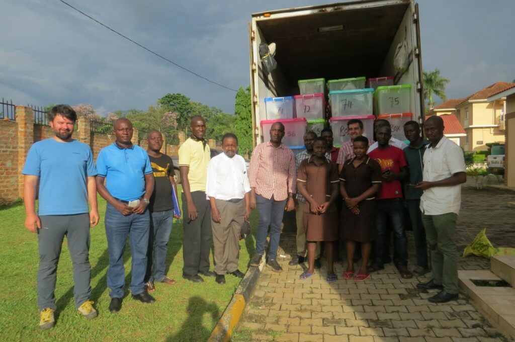
A joint exercise in Mbale (Eastern Uganda) between the client (DGSM), the contractor (Xcalibur Multiphysics) and the quality controller (IGS/PGW) where stream-sediment and bulk-rock samples were inspected and transported to the preparation laboratory in Entebbe. The truck contains samples from the first of nine zones that were successfully sampled, with more to follow. After processing in Entebbe, the samples are sent to a commercial laboratory for multi-element analysis.
(For more information please contact us at enquiries@igsint.com)
IGS (International Geoscience Services) geophysicists continue to carry out quality control and provide technical advisory services to SGS (Saudi Geological Survey) for the Regional Geoscience Program (RGP) Phase 1 geophysics which consists of magnetic gradiometry and radiometrics flown at 300m line spacing over the entire Arabian Shield.
Sander Geophysics is flying Block 1 while Xcalibur is currently flying in Block 3. Both blocks are approaching 50% completion and some final products have been generated for completed portions . There are now 7 aircraft on the project and > 700,000 line kms flown to date. IGS and partners have also assisted the Saudi Geological Survey with developing scope of work for future airborne acquisition phases comprising targeted surveys (e.g. electromagnetics) over areas prospective for mineral deposits.
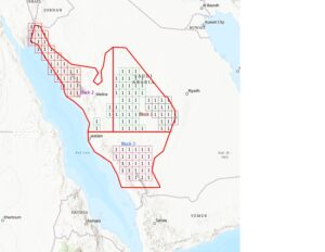
Arabian Shield Phase1 blocks
By Dr. Feargal Murphy – principal geophysicist
(For more information please contact us at enquiries@igsint.com)
IGS was privileged to showcase the company and its services at the large UK Department for International Trade (DIT) stand at Mining Indaba, Cape Town, 6th to 9th February 2023. We received a lot of interest and enquiries with Indaba this year being better attended and having more of a ‘buzz’ than 2022. Certainly, and as always, it was a pleasure to meet up with clients, partners and colleagues.
Dr. Peter Zawada (MD) gave a presentation at the DIT stand entitled ‘Increasing Nation States competitively in the Mineral Sector’. Dr. Ash Johnson (COO) and Dr. Frik Hartzer (Senior Project Manager) of IGS also attended Indaba. It was particularly pleasing to meet up with Government Ministries and Geological Survey officials from across the world under one roof.
(For more information please contact us at enquiries@igsint.com)