IGS as Technical Partner of the Saudi Geological Survey in the GSAS project


The High-Resolution Geochemical Survey of the Arabian Shield (GSAS) project which covers the entire Arabian Shield (c. 600,000 km²), commissioned by the Saudi Geological Survey (SGS) and conducted by the Chinese Geological Survey (CGS) is currently in its second sampling phase.

Since GSAS started at the end of 2021, the project has been making great strides. More than 48 000 stream sediment samples have been successfully collected and progressed by the contractor. The first analytical results are expected in the coming month. The project will have a duration of six years with the sampling and collection of approximately 100,000 sediment samples which will be completed in the first three years.

In its role as the official Technical Partner of the SGS, IGS experts supported by geochemists from the Finish Geological Survey (GTK), advise the client and undertake the quality control of the following project stages: planning, sampling, sample preparation, chemical analysis, data quality, geochemical databasing, statistical analysis of data, interpretation, and geochemical map production.
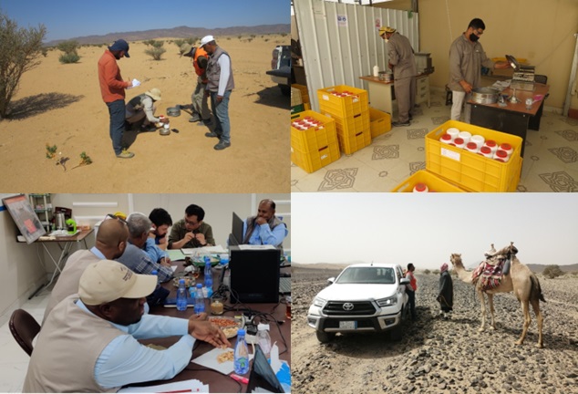
IGS staff inspecting the contractors field work in the GSAS project in KSA. Field inspections on sampling and sample preparation are used to control the quality and accurate application of the established technical project specifications. All quality assessment procedures carried out by IGS and its partners (GTK), take place in constant exchange with the client (SGS) and the contractor (CGS)staff .

By Dr. Reik Degler – Project Geologist
(For more information please contact us at enquiries@igsint.com)

Latest news

IGS Team Delivered Final Phase of 30-Day Capacity Building Training Programme on Digital Geological Mapping at Geological Survey of Pakistan (GSP)

IGS delivers airborne geophysics training workshop to Geological Survey of Pakistan

IGS Delivers a Capacity Building Training programme in the Geological Survey of Pakistan (GSP) on Digital Geological Mapping

IGS is part of UK-supported capacity building initiative aimed at strengthening Pakistan’s geoscientific capabilities in support of its mineral sector

IGS Team Delivered Final Phase of 30-Day Capacity Building Training Programme on Digital Geological Mapping at Geological Survey of Pakistan (GSP)

IGS delivers airborne geophysics training workshop to Geological Survey of Pakistan

IGS Delivers a Capacity Building Training programme in the Geological Survey of Pakistan (GSP) on Digital Geological Mapping

IGS is part of UK-supported capacity building initiative aimed at strengthening Pakistan’s geoscientific capabilities in support of its mineral sector