IGS welcomes new Mapping Geologist
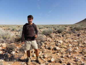
IGS is pleased to announce the arrival of a new member of staff to our team, Dr. Reik Degler.
Following an MSc in Economic Geology at the Freiberg University of Mining and Technology in Germany and a PhD in Tectonics at the Federal University of Minas Gerais in Brazil, Reik has gained considerable geological experience at international level. Beside his research at the Institute of Geosciences during the PhD, he participated as a leading geologist in joint regional scale geological mapping projects on mineral occurrences potential between Brazilian State Governments and the Geological Survey of Brazil.
Reik has been appointed as a Mapping Geologist and will initially be working on our project in Mozambique.
On joining IGS, Reik said “I am very happy to join IGS and look forward to applying my skills in international projects and contributing my part to the continued growth and development of IGS”.
Peter Zawada, Managing Director of IGS, commented “IGS warmly welcomes Reik whose experience will provide very useful contributions to the company’s current and future projects.”
IGS attends PDAC 2019
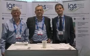 Bill McCourt, Peter Zawada and Feargal Murphy from IGS attended PDAC in Toronto from 3-6 March 2019.
IGS attends Mining Indaba, 2019
Frik Hartzer attended the Mining Indaba 2019 in Cape Town, South Africa in February 2019. The general mood during the Indaba was definitely more optimistic than previous years. South Africa in particular made a major effort to show that recent political changes should eventually be reflected in a better exploration and investment friendly atmosphere. Other countries that made significant presentations were Nigeria and Saudi Arabia. From an IGS perspective the Indaba was successful with established contacts renewed and new contacts generated.
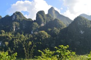
IGS completes Lao Geological Mapping Project
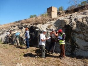
IGS, in partnership with GTK (Finland) and PGW (Canada), recently completed a geological mapping project in Lao PDR. The client was the Government of Lao PDR and it was financed by the World Bank. The project area consisted of two 1: 50 000 map sheets in the Nambak and Ngoy areas of north-central Lao PDR. The project started with a high-density aerial geophysical survey executed by Sanders (Canada). The data was interpreted by PGW in Toronto and integrated with existing geological data by IGS. This was followed by field mapping by IGS and GTK and analyses of geochemical samples. The final products consisted of two geological maps and a comprehensive explanation to the maps including an assessment of the existing mineral deposits of the area and an estimation of the mineral potential elsewhere in the area. The project ended with workshop in Vientiane during which the results were presented to the client.
Completion of the Cameroon Supervision Geology Project
IGS is currently completing a World Bank financed project in Cameroon. The project is titled Supervision d’un programme de cartographie géologique et géochimique et la mise en place d’un Système d’Informations Géologiques et Minières au Cameroun. IGS, under the banner of its previous name BGSi, and in partnership with CGS (South Africa), supervised the project executed by the BRGM. The project started in 2016 and will be finished by March 2019 when the final products are expected.
IGS supervised the implementation of the three main components of the project included geological mapping of 13 map sheets at a scale of 1:200 000, collection and analyses of about 18,500 geochemical samples from the same area and the construction of a national GIS-based database (information system) which will contain all relevant geological information for Cameroon.
IGS assisted Precasem in Cameroon to define the project, wrote the Terms of Reference and assisted them in the evaluation of tenders and the appointment of a consultant. In addition to the role of quality control of the 3 sub-programmes IGS also assisted Precasem in the development of a data management and dissemination policy for the new National Geological Database.
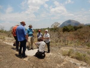
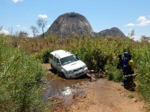
MAGTAP project underway in Mozambique
Following the inception of the World Bank funded Mozambique Mining and Gas Technical Assistance Project (MAGTAP) geological mapping component in April 2018 significant progress in the preparation and production of the preliminary deliverables has been made.
In October 2018, a group of geologists from the four consortium partner organisations (BRGM, Gondwana, IGS, and Mozambique’s Instituto Nacional de Minas (INAMI)) travelled to Nampula Province. Under the leadership of Dr. Frik Hartzer (IGS) and Joao Marques (Gondwana) the team met with officials of the provincial administration and local authorities, and performed a detailed logistical and geological assessment of the field situation. This exercise formed an invaluable part of the ongoing preparation for the field programme, which will start in the second quarter of 2019.
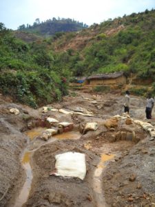
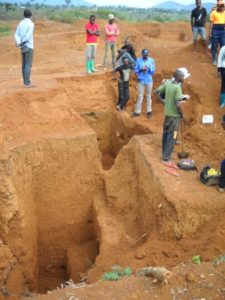
Artisanal mining in the Democratic Republic of Congo
During the closing months of 2018 IGS delivered national- and regional-scale prospectivity analyses of the Democratic Republic of the Congo to the World Bank funded PROMINES project, sub-component: “Assistance Technique dans les Zones d’Exploitation Artisanal.” In a collaborative effort with Johannesburg based MSA Group, IGS’ desktop prospectivity analysis using geological criteria defined by IGS Xplore was supplemented by site visits to three artisanal mining sites in South Kivu and Maniema provinces. The site visits enabled the consortium to provide technical geoscientific and mining engineering input to help develop a coherent, case study-based strategy for the support and expansion of artisanal and small-scale mines in the DRC. The strategy and workflows defined during the project were designed for broad applicability and ease of future implementation by local authorities in the DRC government’s continuing efforts to support artisanal and small scale mining.
IGS completes PROMINES project in the Democratic Republic of Congo
IGS was involved in a series of projects in support of the Ministry of Mines of the Democratic Republic of Congo through the World Bank funded PROMINES project, 2016-2018. Through its staff and associate consultants, IGS provided geoscientific input to two major geothematic mapping projects, namely 1:200,000 scale geological mapping and mineral assessment of 6 x 10 sheets in the Katanga and Equator areas and high resolution airborne geophysical surveys of the same areas, as well a smaller project dealing with the ASM sector. The geological mapping programme was carried out in partnership with BRGM, as lead contractor, and a local company and also involved a complimentary geochemical exploration programme based on stream sediment samples. The high-resolution regional airborne survey was flown by New Resolution Geophysics of South Africa at 400m line spacing, 200m over selected target areas, and 316,800 lkms of MAG-RAD data were acquired which was interpreted by PGW of Toronto. IGS was responsible for the overall management and technical coordination of the project on behalf of the Ministry.
IGS completes five-year association with the Burkina Faso Mines Bureau (BUMIGEB)
IGS has successfully completed a 5 year association (2013-18) with the Bureau des Mines et de la Géologie du Burkina (BUMIGEB) providing geoscientific Technical Assistance under the World Bank supported PADSEM project, 2012-2018. Through its staff and associate consultants, IGS has been responsible for the technical supervision and quality control of a series of regional geothematic mapping surveys. These included multi-sensor (magnetics & radiometrics) high-resolution airborne geophysical surveys over an area of 134,400 km2 covering the eastern half of the country (Blocks A, B & D) flown at 400m line-spacing; a geological/structural mapping and mineral assessment of 13 x 1:200,000 scale sheets; the compilation of a new 1:1,000,000 national map; and regional geochemical sampling of the southwestern sector of the country at a density of 1/10km2. In addition IGS provided technical assistance to BUMIGEB in the development of a geoscience database and web-based portal to facilitate controlled access to the new geodata to promote investment into the mining and mineral sector through exploration.
IGS and the Geological Survey of India
IDPeX (which is a joint-venture partnership between IGS, PGW of Toronto and Datacode Intl. of Nagpur, India) has recently completed tender supervision and quality control (TSQC) of Blocks 1,2 and 4 of the Geological Survey of India’s (GSI) OGP Year 1 multi-sensor airborne geophysical survey programme. This forms part of India’s national high resolution geophysical program of ‘Areas of Obvious Geological Potential’ that covers an area of 813 000 km2. IDPeX presented a review of its Year 1 work at a recent workshop held at GSI, Bangalore.
IDPeX has been working closely with GSI and PIAs (Project Implementation Agencies) throughout the Y1 programme and the results provide a modern high resolution database for use by mineral exploration and other sectors.
IDPEX has also recently signed a contract with GSI for the interpretation of legacy data and consultancy in setting terms of reference for new detailed surveys in areas of specific mineral exploration interest.