Mozambique MAGTAP project – Supervisory team meets field team during second field campaign

The MAGTAP technical supervision team (Hannu Makitie and Esko Korkiakoski), and representatives of the client organisations INAMI (Vladimiro Manhica) and DNGM (Elias Daudi), visited the field team during the second field campaign. The field team consists of geologists from IGS, BRGM, GONDWANA, INAMI, DNGM, and DIPREME Nampula. They undertook a joint field excursion through the north-eastern part of map sheet Malema (394) which exposes granulites. The second field campaign started on 26 August and is operating from a field camp near Malema in Nampula Province. The four 1:50,000 map sheets being surveyed are Mutuali (393), Malema (394), Nintulo (433) and Inago (434).
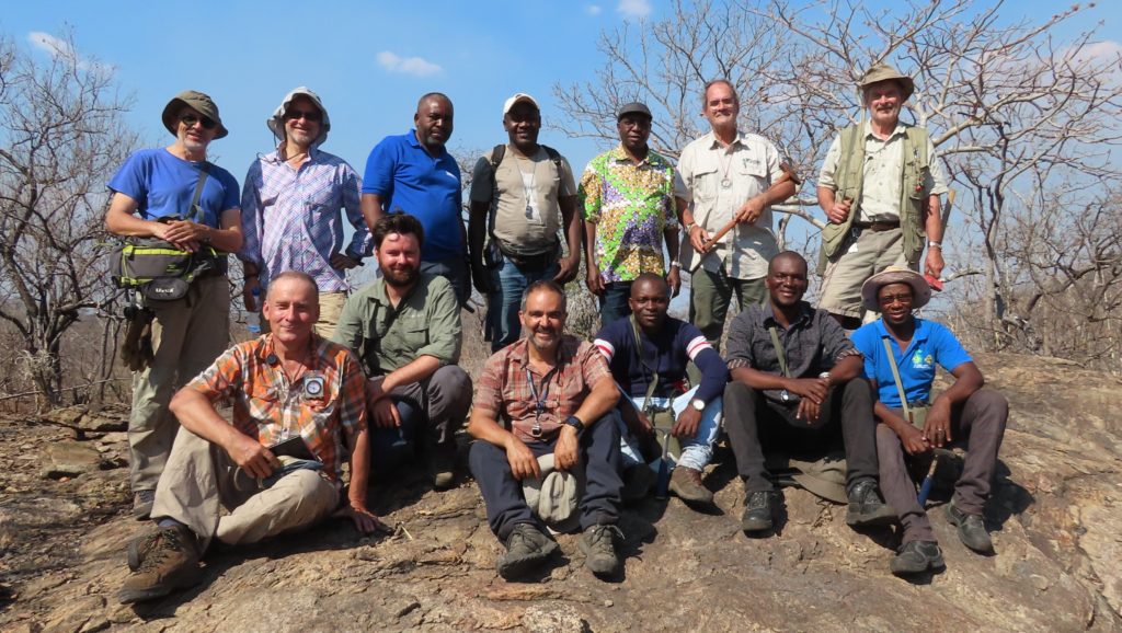
Joint field excursion of supervisory team and field team. Top row (from left to right): Christoph J. Dobmeier (IGS, team leader), Esko Korkiakoski (GTK), Vladimiro Manhica (INAMI), Rogerio Matola (DNGM), Elias Daudi (DNGM), Joao Marques (GONDWANA, deputy project manager), Tuomo Manninen (GONDWANA); front row: Hannu Makitie (GTK), Reik Degler (IGS), Olivier Blein (BRGM), Honesto Adamo (DIPREME Nampula), Fila Lazaro (DIPREME Nampula), Temoteo Adriano (INAMI).
Photo credit: Didier Lahondere (BRGM).

Latest news

IGS Team Delivered Final Phase of 30-Day Capacity Building Training Programme on Digital Geological Mapping at Geological Survey of Pakistan (GSP)

IGS delivers airborne geophysics training workshop to Geological Survey of Pakistan

IGS Delivers a Capacity Building Training programme in the Geological Survey of Pakistan (GSP) on Digital Geological Mapping

IGS is part of UK-supported capacity building initiative aimed at strengthening Pakistan’s geoscientific capabilities in support of its mineral sector

IGS Team Delivered Final Phase of 30-Day Capacity Building Training Programme on Digital Geological Mapping at Geological Survey of Pakistan (GSP)

IGS delivers airborne geophysics training workshop to Geological Survey of Pakistan

IGS Delivers a Capacity Building Training programme in the Geological Survey of Pakistan (GSP) on Digital Geological Mapping

IGS is part of UK-supported capacity building initiative aimed at strengthening Pakistan’s geoscientific capabilities in support of its mineral sector